Affected by its peripheral circulation, the wind along the coast of Guangdong will be strong in the next one or two days, and Hong Kong will have heavy rain and thunderstorms tomorrow and Wednesday (6 and 7), heavy rain and thunderstorms in local areas, and medium level 6 (strong wind) between offshore winds, i.e. Typhoon No. 3. On the eve of the storm, the torrential rain in Hong Kong this morning brought double rainbows, attracting many people to shoot while going to work.
The cloud organization near the monsoon low pressure center is still relatively loose and it is unknown whether it will strengthen again. The Mainland's Central Meteorological Observatory predicts that one to two typhoons will form in the South China Sea and the Northwest Pacific Ocean in the next 10 days.
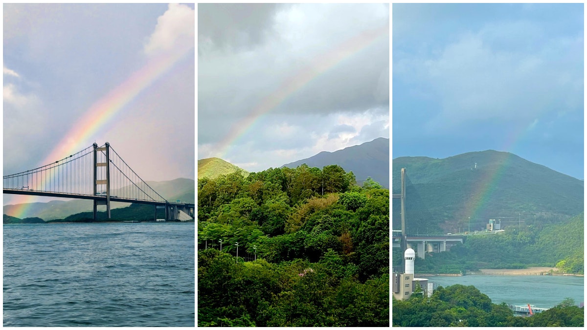
▼June 6 Rainbows hang high in various districts on the morning of June 5▼
+11
Monsoon low pressure winds are weak inside and strong outside as opposed to mature tropical cyclones
According to the observatory data, in the summer of the northern hemisphere, a band of thousands of kilometers full of deep clouds sometimes appears on satellite cloud images, meteorologically called the tropical convergence zone, and the section from the South China Sea to the Indian Ocean is called the "monsoon trough". Due to the two "opposing winds" of the southwest monsoon and the northeast trade wind blowing on the north and south sides, convective activity is easy to erupt on the monsoon trough and develop into a low-pressure area, collectively known as monsoon depression.
Although both monsoon depressions and mature tropical cyclones have rotational circulation, there are significant structural differences (table). As for whether the former will evolve into the latter, it depends on whether the atmospheric environment (vertical wind field differences, water and gas transport, sea water temperature, high-altitude radiation, etc.) is coordinated.
Monsoon low-pressure winds are weak inside and strong outside, as opposed to tropical cyclone systems. (Observatory photo)
Monsoon depressions can develop into tropical cyclones
On July 2020, 7, a monsoon depression over the South China Sea brought high winds to Hong Kong, and the Observatory issued a strong monsoon signal in the morning, commonly known as black balls, representing winds close to sea level in Hong Kong that were close to or exceeding 31 kilometers per hour, or Typhoon Wave No. 40. The monsoon depression developed during the day , the central wind rose , and at night it evolved into a tropical cyclone , and named " Senrak " , the observatory directly emitted Typhoon No. 3 at night and skipped to send Typhoon No. 3 , which was the sixth time in history that a strong monsoon signal was directly changed to Typhoon No. 1.
At present, there is a low pressure area in the northern part of the South China Sea, which is a monsoon depression and it is unknown whether it will strengthen into a tropical cyclone system. (Observatory photo)
As for the reappearance of monsoon depression strengthening into a tropical cyclone this time? The observatory pointed out that the cloud formation near the center of the monsoon depression is still relatively loose and is expected to move to the area from Hainan Island to Beibu Gulf in the next day or two. However, affected by its peripheral circulation, the wind along the Guangdong coast will be relatively strong in the next one or two days, with occasional sudden rain and violent wind and thunderstorms, and heavy rain in local areas. The Observatory will closely monitor whether the monsoon depression will further develop and its impact on Hong Kong.
The Observatory issued a special weather reminder Monsoon low pressure impact In the next few days, sudden rain and violent winds and thunderstorms will reach a maximum temperature of more than 9 degrees for 31 consecutive days Tuesday after the mangseed, hot and rainy, summer heat warning|yellow work summer heat warning once took effect for two hours Labour Department reminds caution against heat stroke, the observatory issues extreme heat reminder The urban area is 35.2 degrees, the hottest this year Next week's unstable weather, consecutive days of rain and heat warning|yellow work summer heat warning "three up and three down" Two warnings, the shortest interval of 10 minutes, weather|today's maximum of 33 degrees Several bursts of rain and thunderstorms Another hot weather warning