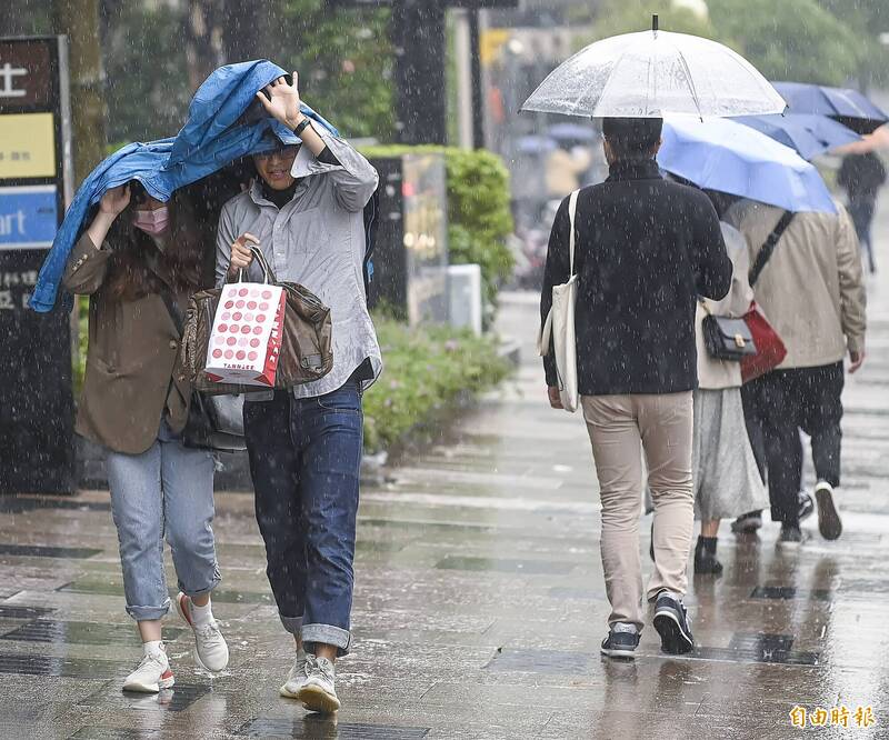
The Bureau of Meteorology reminded that Yilan and the mountainous areas of Greater Taipei are prone to localized heavy rain on Wednesday. It is recommended to carry rain gear when going out.
(file photo)
[Instant News/Comprehensive Report] Tomorrow (4) will continue to be affected by the northeast monsoon, and the weather will be similar to today. It is also a weather prone to heavy rain in the northeast. In addition, northern Taiwan still feels cooler, with a daytime temperature of only about 20 degrees. In addition to recommending to bring rain gear when going out, please also wear a few more clothes to avoid catching cold.
According to the forecast of the Central Meteorological Bureau, on Wednesday, the north and east half of Taoyuan on the windward side and the Hengchun Peninsula will be cloudy throughout the day, with occasional localized rainfall. Among them, the rainfall in the north coast of Keelung, Yilan area and the mountainous area of Greater Taipei is relatively continuous, and it is easy to There is a chance of local heavy rain. As for the area south of Hsinchu, it is still affected by the eastward movement of the cloud and rain area in South China in the first half of the day, and the cloud cover is also relatively high. In the second half of the day, the water vapor gradually decreases, and the sun can gradually be seen. In addition, the mountainous areas still need to pay attention to sporadic rainfall. Chance.
Please read on...
In terms of temperature, the western half and Yilan have a low temperature of 14 to 16 degrees in the morning at night, Huadong 17 to 19 degrees, the high temperature in northern Taiwan is about 20 degrees during the day, and other places are about 23 to 25 degrees, which is relatively warm and comfortable.
The weather risk company reminded that the weather forecast on Wednesday will still be affected by the northeast monsoon. There may be heavy rain in the northeast corner, and it will turn to an easterly wind environment on Thursday, and the rainfall in the eastern half will also become heavier. Obviously, due to the development of low pressure in the northeast on Friday, it will bring rain to the north of Miaoli. However, the dry air moving south on Saturday will improve the weather in Taiwan, and sunshine is expected to be seen by then.
In terms of UV index, Taipei City, New Taipei City, Keelung City, Yilan County, and Lianjiang County are at the low level, while other counties and cities are slightly higher at the middle level.
In terms of air quality, affected by the northeast monsoon on the 4th, the north of the central part is located on the windward side.
Zhumiao, Central, Yilan, Huadong Kongpin District, and Penghu are "good" grades; North, Yunjianan, Gaoping Kongpin District, Matsu, and Kinmen are "average" grades, and some areas in Gaoping may reach orange in the early morning to morning Color reminder level.
The Meteorological Bureau also reminded that the northeasterly wind is obviously stronger. There are strong gusts of magnitude 9 to 10 in the north of Tainan, in the open coastal areas of the Hengchun Peninsula, and in Orchid Island, Green Island, Penghu, Kinmen, and Matsu. There are also areas from Keelung, Taoyuan to Changhua Strong gusty winds, large waves near the sea; in addition, there is a possibility of long waves in the east, southeast and Hengchun Peninsula, please pay attention to safety when engaging in sea or seaside activities.
Tomorrow, the high temperature in northern Taiwan will be about 20 degrees during the day, and the overall feeling will be cooler. In other places, it will be about 23 to 25 degrees, and it will feel warmer.
(taken from Central Meteorological Bureau)
The UV Index reached mid-range in most counties and cities Wednesday.
(taken from Central Meteorological Bureau)
In terms of empty products, Zhumiao, Central, Yilan, Huadong Kongpin District and Penghu are "good" grades; North, Yunjianan, Gaoping Kongpin District, Matsu, and Kinmen are "average" grades, and some areas in Gaoping are in the early morning. It may reach orange alert level in the morning.
(Extracted from the Air Quality Monitoring Network of the Environmental Protection Agency)